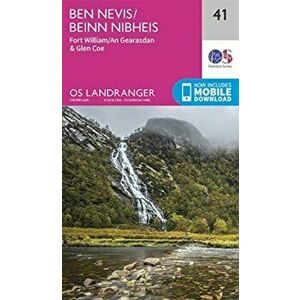
Ben Nevis. Fort William & Glen Coe, Sheet Map - ***61,99 RON.Publisher: Ordnance SurveyCollection: OS Landranger MapPublication date: 2021Dimensions: 227 x 133 x 22Cover type: Sheet map, foldedordnance survey, carti, carte straina, lifestyleelefant.roSimilar cu Ben Nevis. Fort William & Glen Coe, Sheet Map - ***
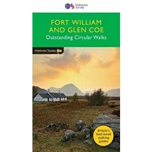
Fort William & Glen Coe, Paperback - ***81,99 RON28 fabulous walks in the beautiful Fort William and Glen Coe countryside. Graded by length and difficulty, and varying from 3 to 10 miles, routes r...ordnance survey, carti, carte straina, lifestyleelefant.roSimilar cu Fort William & Glen Coe, Paperback - ***
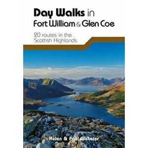
Day Walks in Fort William & Glen Coe. 20 routes in the Scottish Highlands, Paperback - Paul Webster110,99 RONDay Walks in Fort William & Glen Coe by Helen and Paul Webster features 20 routes suitable for hillwalkers of all abilities. Together with stunning...vertebrate publishing ltd, carti, carte straina, lifestyleelefant.roSimilar cu Day Walks in Fort William & Glen Coe. 20 routes in the Scottish Highlands, Paperback - Paul Webster
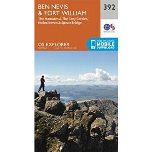
Ben Nevis and Fort William, the Mamores and the Grey Corries, Kinlochleven and Spean Bridge. September 2015 ed, Sheet Map - Ordnance Survey61,99 RONPublisher: Ordnance SurveyAuthor(s): Ordnance SurveyCollection: OS Explorer MapPublication date: 2015Dimensions: 235 x 133 x 14Cover type: Sheet ma...ordnance survey, carti, carte straina, lifestyleelefant.roSimilar cu Ben Nevis and Fort William, the Mamores and the Grey Corries, Kinlochleven and Spean Bridge. September 2015 ed, Sheet Map - Ordnance Survey
Ben Nevis and Fort William, the Mamores and the Grey Corries, Kinlochleven and Spean Bridge. September 2015 ed, Sheet Map - Ordnance Survey98,99 RONPublisher: Ordnance SurveyAuthor(s): Ordnance SurveyCollection: OS Explorer Active MapPublication date: 2015Dimensions: 139 x 242 x 21Cover type: S...ordnance survey, carti, carte straina, lifestyleelefant.roSimilar cu Ben Nevis and Fort William, the Mamores and the Grey Corries, Kinlochleven and Spean Bridge. September 2015 ed, Sheet Map - Ordnance Survey
Explore Fort William and Glen Nevis. A Detailed Tourist Guide, Paperback - Brian Smailes39,99 RONPublisher: Challenge PublicationsAuthor(s): Brian SmailesIllustration(s): 24 colour photos, 2 b/w sketch mapsNumber of pages: 64Publication date: 2...challenge publications, carti, carte straina, lifestyleelefant.roSimilar cu Explore Fort William and Glen Nevis. A Detailed Tourist Guide, Paperback - Brian Smailes
Ben Nevis and Glen Coe. 100 low, mid, and high level walks, Paperback - Ronald Turnbull94,99 RONGuidebook to walking in Scotland's Ben Nevis and Glen Coe region, featuring 100 graded walks of 2 to 21 miles. The routes range from gentle walks t...cicerone press, carti, carte straina, lifestyleelefant.roSimilar cu Ben Nevis and Glen Coe. 100 low, mid, and high level walks, Paperback - Ronald Turnbull
Highland Scrambles South. Including Cairngorms, Ben Nevis, Glen Coe, Rum and Arran, Paperback - Iain Thow213,99 RONThis guide describes some of the best scrambles and easy rock climbs to be found in Scotland (excepting Skye and the Northern Highlands which are d...scottish mountaineering club, carti, carte straina, sports & active outdoor recreationelefant.roSimilar cu Highland Scrambles South. Including Cairngorms, Ben Nevis, Glen Coe, Rum and Arran, Paperback - Iain Thow
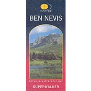
Ben Nevis XT25. 2 ed, Sheet Map - Harvey Map Services Ltd.113,99 RONPublisher: Harvey Map Services LtdAuthor(s): Harvey Map Services Ltd.Illustration(s): 2 mapsCollection: SuperwalkerPublication date: 2017Dimensions...harvey map services ltd, carti, carte straina, lifestyleelefant.roSimilar cu Ben Nevis XT25. 2 ed, Sheet Map - Harvey Map Services Ltd.
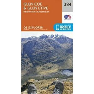
Glen Coe. September 2015 ed, Sheet Map - Ordnance Survey61,99 RONPublisher: Ordnance SurveyAuthor(s): Ordnance SurveyCollection: OS Explorer MapPublication date: 2015Dimensions: 234 x 134 x 13Cover type: Sheet ma...ordnance survey, carti, carte straina, lifestyleelefant.roSimilar cu Glen Coe. September 2015 ed, Sheet Map - Ordnance Survey
Fort Augustus, Glen Roy & Glen Moriston. February 2016 ed, Sheet Map - Ordnance Survey98,99 RONPublisher: Ordnance SurveyAuthor(s): Ordnance SurveyCollection: OS Landranger Active MapPublication date: 2016Dimensions: 218 x 137 x 21Cover type:...ordnance survey, carti, carte straina, lifestyleelefant.roSimilar cu Fort Augustus, Glen Roy & Glen Moriston. February 2016 ed, Sheet Map - Ordnance Survey
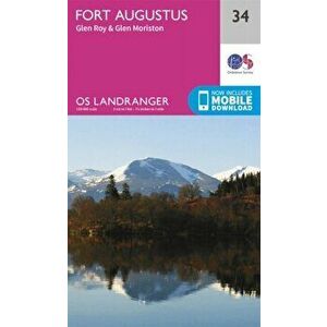
Fort Augustus, Glen Roy & Glen Moriston. February 2016 ed, Sheet Map - Ordnance Survey61,99 RONPublisher: Ordnance SurveyAuthor(s): Ordnance SurveyCollection: OS Landranger MapPublication date: 2016Dimensions: 226 x 140 x 10Cover type: Sheet ...ordnance survey, carti, carte straina, lifestyleelefant.roSimilar cu Fort Augustus, Glen Roy & Glen Moriston. February 2016 ed, Sheet Map - Ordnance Survey
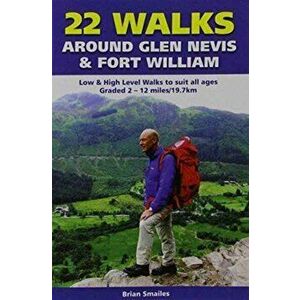
22 Walks Around Glen Nevis & Fort William. Low & High Level Walks to Suit All Ages, Paperback - Brian Gordon Smailes23,99 RONPublisher: Challenge PublicationsAuthor(s): Brian Gordon SmailesIllustration(s): 1 colour photograph, 23 colour sketchesNumber of pages: 47Publicat...challenge publications, carti, carte straina, lifestyleelefant.roSimilar cu 22 Walks Around Glen Nevis & Fort William. Low & High Level Walks to Suit All Ages, Paperback - Brian Gordon Smailes
Ben Lawers & Glen Lyon, Loch Tay, Killin & Kenmore, Sheet Map - ***94,99 RONOS Explorer is the Ordnance Survey's most detailed map and is recommended for anyone enjoying outdoor activities such as walking, horse riding and ...ordnance survey, carti, carte straina, lifestyleelefant.roSimilar cu Ben Lawers & Glen Lyon, Loch Tay, Killin & Kenmore, Sheet Map - ***
Loch Arkaig - Fort William and Corpach. September 2015 ed, Sheet Map - Ordnance Survey98,99 RONPublisher: Ordnance SurveyAuthor(s): Ordnance SurveyCollection: OS Explorer Active MapPublication date: 2015Dimensions: 242 x 143 x 22Cover type: S...ordnance survey, carti, carte straina, lifestyleelefant.roSimilar cu Loch Arkaig - Fort William and Corpach. September 2015 ed, Sheet Map - Ordnance Survey
Loch Arkaig - Fort William and Corpach. September 2015 ed, Sheet Map - Ordnance Survey61,99 RONPublisher: Ordnance SurveyAuthor(s): Ordnance SurveyCollection: OS Explorer MapPublication date: 2015Dimensions: 240 x 148 x 13Cover type: Sheet ma...ordnance survey, carti, carte straina, lifestyleelefant.roSimilar cu Loch Arkaig - Fort William and Corpach. September 2015 ed, Sheet Map - Ordnance Survey
Braemar, Tomintoul & Glen Avon, Beinn a' Bhuird & Ben Avon, Sheet Map - ***56,99 RONOS Explorer is the Ordnance Survey's most detailed map and is recommended for anyone enjoying outdoor activities like walking, horse riding and off...ordnance survey, carti, carte straina, lifestyleelefant.roSimilar cu Braemar, Tomintoul & Glen Avon, Beinn a' Bhuird & Ben Avon, Sheet Map - ***
Braemar, Tomintoul & Glen Avon, Beinn a' Bhuird & Ben Avon, Sheet Map - ***94,99 RONOS Explorer is the Ordnance Survey's most detailed map and is recommended for anyone enjoying outdoor activities such as walking, horse riding and ...ordnance survey, carti, carte straina, lifestyleelefant.roSimilar cu Braemar, Tomintoul & Glen Avon, Beinn a' Bhuird & Ben Avon, Sheet Map - ***
Loch Lochy and Glen Roy - Spean Bridge, Invergarry and Fort Augustus. September 2015 ed, Sheet Map - Ordnance Survey98,99 RONPublisher: Ordnance SurveyAuthor(s): Ordnance SurveyCollection: OS Explorer Active MapPublication date: 2015Dimensions: 237 x 137 x 21Cover type: S...ordnance survey, carti, carte straina, lifestyleelefant.roSimilar cu Loch Lochy and Glen Roy - Spean Bridge, Invergarry and Fort Augustus. September 2015 ed, Sheet Map - Ordnance Survey
Loch Lochy and Glen Roy - Spean Bridge, Invergarry and Fort Augustus. September 2015 ed, Sheet Map - Ordnance Survey61,99 RONPublisher: Ordnance SurveyAuthor(s): Ordnance SurveyCollection: OS Explorer MapPublication date: 2015Dimensions: 239 x 146 x 13Cover type: Sheet ma...ordnance survey, carti, carte straina, lifestyleelefant.roSimilar cu Loch Lochy and Glen Roy - Spean Bridge, Invergarry and Fort Augustus. September 2015 ed, Sheet Map - Ordnance Survey
Ben Lawers & Glen Lyon, Loch Tay, Killin & Kenmore. May 2015 ed, Sheet Map - Ordnance Survey61,99 RONOS Explorer is the Ordnance Survey's most detailed map and is recommended for anyone enjoying outdoor activities like walking, horse riding and off...ordnance survey, carti, carte straina, lifestyleelefant.roSimilar cu Ben Lawers & Glen Lyon, Loch Tay, Killin & Kenmore. May 2015 ed, Sheet Map - Ordnance Survey
Cape Wrath Trail South XT40. Fort William to Srathcarron, Sheet Map - Harvey Map Services Ltd.129,99 RONPublisher: Harvey Map Services LtdAuthor(s): Harvey Map Services Ltd.Collection: Trail Map XT40Publication date: 2019Dimensions: 120 x 244 x 4Cover...harvey map services ltd, carti, carte straina, lifestyleelefant.roSimilar cu Cape Wrath Trail South XT40. Fort William to Srathcarron, Sheet Map - Harvey Map Services Ltd.
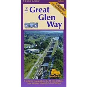
The West Highland Way (Footprint Map). A Footprint Map-Guide to the 95 Mile Route Between Milngavie and Fort William, New ed, Sheet Map - ***92,99 RONThe West Highland Way waterproof map from Footprint is a map-guide to the 95 mile (153km) route between Milngavie and Fort William. The mapping is ...footprint maps, carti, carte straina, lifestyleelefant.roSimilar cu The West Highland Way (Footprint Map). A Footprint Map-Guide to the 95 Mile Route Between Milngavie and Fort William, New ed, Sheet Map - ***
Lochnagar, Glen Muick & Glen Clova, Ballater & Balmoral, Sheet Map - ***56,99 RONOS Explorer is the Ordnance Survey's most detailed map and is recommended for anyone enjoying outdoor activities like walking, horse riding and off...ordnance survey, carti, carte straina, lifestyleelefant.roSimilar cu Lochnagar, Glen Muick & Glen Clova, Ballater & Balmoral, Sheet Map - ***
Glen Affric and Glen Moriston. September 2015 ed, Sheet Map - Ordnance Survey98,99 RONPublisher: Ordnance SurveyAuthor(s): Ordnance SurveyCollection: OS Explorer Active MapPublication date: 2015Dimensions: 225 x 127 x 21Cover type: S...ordnance survey, carti, carte straina, lifestyleelefant.roSimilar cu Glen Affric and Glen Moriston. September 2015 ed, Sheet Map - Ordnance Survey
Glen Carron & Glen Affric. February 2016 ed, Sheet Map - Ordnance Survey98,99 RONPublisher: Ordnance SurveyAuthor(s): Ordnance SurveyCollection: OS Landranger Active MapPublication date: 2016Dimensions: 228 x 135 x 20Cover type:...ordnance survey, carti, carte straina, lifestyleelefant.roSimilar cu Glen Carron & Glen Affric. February 2016 ed, Sheet Map - Ordnance Survey
Glen Cassley and Glen Oykel. September 2015 ed, Sheet Map - Ordnance Survey98,99 RONPublisher: Ordnance SurveyAuthor(s): Ordnance SurveyCollection: OS Explorer Active MapPublication date: 2015Dimensions: 135 x 221 x 21Cover type: S...ordnance survey, carti, carte straina, lifestyleelefant.roSimilar cu Glen Cassley and Glen Oykel. September 2015 ed, Sheet Map - Ordnance Survey
Glen Carron & Glen Affric. February 2016 ed, Sheet Map - Ordnance Survey61,99 RONPublisher: Ordnance SurveyAuthor(s): Ordnance SurveyCollection: OS Landranger MapPublication date: 2016Dimensions: 223 x 147 x 10Cover type: Sheet ...ordnance survey, carti, carte straina, lifestyleelefant.roSimilar cu Glen Carron & Glen Affric. February 2016 ed, Sheet Map - Ordnance Survey
Glen Cassley and Glen Oykel. September 2015 ed, Sheet Map - Ordnance Survey61,99 RONPublisher: Ordnance SurveyAuthor(s): Ordnance SurveyCollection: OS Explorer MapPublication date: 2015Dimensions: 221 x 135 x 10Cover type: Sheet ma...ordnance survey, carti, carte straina, lifestyleelefant.roSimilar cu Glen Cassley and Glen Oykel. September 2015 ed, Sheet Map - Ordnance Survey
Walks Fort William and District, Paperback - Trina Wombell18,99 RONPublisher: Hallewell PublicationsAuthor(s): Trina WombellIllustration(s): 12ill.28M.Number of pages: 32Publication date: 2014Dimensions: 156 x 140 ...hallewell publications, carti, carte straina, lifestyleelefant.roSimilar cu Walks Fort William and District, Paperback - Trina Wombell
Loch Monar, Glen Cannich and Glen Strathfarrar. September 2015 ed, Sheet Map - Ordnance Survey98,99 RONPublisher: Ordnance SurveyAuthor(s): Ordnance SurveyCollection: OS Explorer Active MapPublication date: 2015Dimensions: 232 x 137 x 23Cover type: S...ordnance survey, carti, carte straina, lifestyleelefant.roSimilar cu Loch Monar, Glen Cannich and Glen Strathfarrar. September 2015 ed, Sheet Map - Ordnance Survey
Loch Monar, Glen Cannich and Glen Strathfarrar. September 2015 ed, Sheet Map - Ordnance Survey61,99 RONPublisher: Ordnance SurveyAuthor(s): Ordnance SurveyCollection: OS Explorer MapPublication date: 2015Dimensions: 236 x 139 x 13Cover type: Sheet ma...ordnance survey, carti, carte straina, lifestyleelefant.roSimilar cu Loch Monar, Glen Cannich and Glen Strathfarrar. September 2015 ed, Sheet Map - Ordnance Survey
Glen Esk & Glen Tanar, Aboyne & Mount Keen. May 2015 ed, Sheet Map - Ordnance Survey61,99 RONOS Explorer is the Ordnance Survey's most detailed map and is recommended for anyone enjoying outdoor activities like walking, horse riding and off...ordnance survey, carti, carte straina, lifestyleelefant.roSimilar cu Glen Esk & Glen Tanar, Aboyne & Mount Keen. May 2015 ed, Sheet Map - Ordnance Survey
Lochnagar, Glen Muick & Glen Clova, Ballater & Balmoral. May 2015 ed, Sheet Map - Ordnance Survey98,99 RONOS Explorer is the Ordnance Survey's most detailed map and is recommended for anyone enjoying outdoor activities such as walking, horse riding and ...ordnance survey, carti, carte straina, lifestyleelefant.roSimilar cu Lochnagar, Glen Muick & Glen Clova, Ballater & Balmoral. May 2015 ed, Sheet Map - Ordnance Survey
Glen Esk & Glen Tanar, Aboyne & Mount Keen. May 2015 ed, Sheet Map - Ordnance Survey98,99 RONOS Explorer is the Ordnance Survey's most detailed map and is recommended for anyone enjoying outdoor activities such as walking, horse riding and ...ordnance survey, carti, carte straina, lifestyleelefant.roSimilar cu Glen Esk & Glen Tanar, Aboyne & Mount Keen. May 2015 ed, Sheet Map - Ordnance Survey
Great Glen Way XT40, Sheet Map - Harvey Map Services Ltd.117,99 RONPublisher: Harvey Map Services LtdAuthor(s): Harvey Map Services Ltd.Illustration(s): 1 mapCollection: Route MapPublication date: 2019Dimensions: 2...harvey map services ltd, carti, carte straina, lifestyleelefant.roSimilar cu Great Glen Way XT40, Sheet Map - Harvey Map Services Ltd.
Crieff, Comrie & Glen Artney, Strathearn & Auchterarder, Sheet Map - ***94,99 RONOS Explorer is the Ordnance Survey's most detailed map and is recommended for anyone enjoying outdoor activities such as walking, horse riding and ...ordnance survey, carti, carte straina, lifestyleelefant.roSimilar cu Crieff, Comrie & Glen Artney, Strathearn & Auchterarder, Sheet Map - ***
Atholl, Glen Tilt, Beinn Dearg & Carn nan Gabhar, Sheet Map - ***94,99 RONOS Explorer is the Ordnance Survey's most detailed map and is recommended for anyone enjoying outdoor activities such as walking, horse riding and ...ordnance survey, carti, carte straina, lifestyleelefant.roSimilar cu Atholl, Glen Tilt, Beinn Dearg & Carn nan Gabhar, Sheet Map - ***
Atholl, Glen Tilt, Beinn Dearg & Carn nan Gabhar, Sheet Map - ***56,99 RONOS Explorer is the Ordnance Survey's most detailed map and is recommended for anyone enjoying outdoor activities like walking, horse riding and off...ordnance survey, carti, carte straina, lifestyleelefant.roSimilar cu Atholl, Glen Tilt, Beinn Dearg & Carn nan Gabhar, Sheet Map - ***
Glen Urquhart and Strathglass. September 2015 ed, Sheet Map - Ordnance Survey61,99 RONPublisher: Ordnance SurveyAuthor(s): Ordnance SurveyCollection: OS Explorer MapPublication date: 2015Dimensions: 242 x 131 x 9Cover type: Sheet map...ordnance survey, carti, carte straina, lifestyleelefant.roSimilar cu Glen Urquhart and Strathglass. September 2015 ed, Sheet Map - Ordnance Survey
Glen Urquhart and Strathglass. September 2015 ed, Sheet Map - Ordnance Survey98,99 RONPublisher: Ordnance SurveyAuthor(s): Ordnance SurveyCollection: OS Explorer Active MapPublication date: 2015Dimensions: 240 x 136 x 19Cover type: S...ordnance survey, carti, carte straina, lifestyleelefant.roSimilar cu Glen Urquhart and Strathglass. September 2015 ed, Sheet Map - Ordnance Survey
The Great Glen Way. Waterproof Map-Guide, 2 Revised edition, Sheet Map - Footprint Maps83,99 RONA Footprint map-guide to the 95 mile (153km) route between Milngavie & Fort William. A 1: 40, 000 scale map based on OS data, printed on waterproof...footprint maps, carti, carte straina, lifestyleelefant.roSimilar cu The Great Glen Way. Waterproof Map-Guide, 2 Revised edition, Sheet Map - Footprint Maps
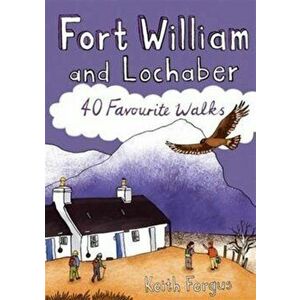
Fort William and Lochaber. 40 Favourite Walks, Paperback - Keith Fergus42,99 RONThis guide features 40 varied walks that take in the very best of Lochaber. From the iconic Glencoe and Glen Nevis to the wild lands of Ardnamurcha...pocket mountains ltd, carti, carte straina, sports & active outdoor recreationelefant.roSimilar cu Fort William and Lochaber. 40 Favourite Walks, Paperback - Keith Fergus
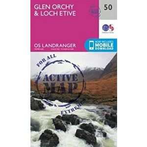
Glen Orchy & Loch Etive. February 2016 ed, Sheet Map - Ordnance Survey98,99 RONPublisher: Ordnance SurveyAuthor(s): Ordnance SurveyCollection: OS Landranger Active MapPublication date: 2016Dimensions: 217 x 143 x 20Cover type:...ordnance survey, carti, carte straina, lifestyleelefant.roSimilar cu Glen Orchy & Loch Etive. February 2016 ed, Sheet Map - Ordnance Survey
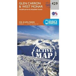
Glen Carron and West Monar. September 2015 ed, Sheet Map - Ordnance Survey98,99 RONPublisher: Ordnance SurveyAuthor(s): Ordnance SurveyCollection: OS Explorer Active MapPublication date: 2015Dimensions: 135 x 242 x 24Cover type: S...ordnance survey, carti, carte straina, lifestyleelefant.roSimilar cu Glen Carron and West Monar. September 2015 ed, Sheet Map - Ordnance Survey
Loch Etive and Glen Orchy. September 2015 ed, Sheet Map - Ordnance Survey98,99 RONPublisher: Ordnance SurveyAuthor(s): Ordnance SurveyCollection: OS Explorer Active MapPublication date: 2015Dimensions: 139 x 229 x 23Cover type: S...ordnance survey, carti, carte straina, lifestyleelefant.roSimilar cu Loch Etive and Glen Orchy. September 2015 ed, Sheet Map - Ordnance Survey
Glen Garry & Loch Rannoch. February 2016 ed, Sheet Map - Ordnance Survey98,99 RONPublisher: Ordnance SurveyAuthor(s): Ordnance SurveyCollection: OS Landranger Active MapPublication date: 2016Dimensions: 231 x 142 x 22Cover type:...ordnance survey, carti, carte straina, lifestyleelefant.roSimilar cu Glen Garry & Loch Rannoch. February 2016 ed, Sheet Map - Ordnance Survey
Loch Tay & Glen Dochart. February 2016 ed, Sheet Map - Ordnance Survey98,99 RONPublisher: Ordnance SurveyAuthor(s): Ordnance SurveyCollection: OS Landranger Active MapPublication date: 2016Dimensions: 230 x 144 x 21Cover type:...ordnance survey, carti, carte straina, lifestyleelefant.roSimilar cu Loch Tay & Glen Dochart. February 2016 ed, Sheet Map - Ordnance Survey
Court of Thorns and Roses, Paperback - Sarah J. Maas5 produsebloomsbury publishing plc, carti, carte straina, fiction & related items, fantasyCartiMuzica.roToate Court of Thorns and Roses, Paperback - Sarah J. Maas
The Iliad for Boys and Girls - Alfred J. Church5 produseyesterday's classics, carti, carte straina, fiction & related items, myth & legend told as fictionCartiMuzica.roToate The Iliad for Boys and Girls - Alfred J. Church
The Tragedy of Romeo and Juliet, Paperback - William Shakespeare9 produsefocus publishing/r pullins & co, carti, carte straina, biographyCartiMuzica.roToate The Tragedy of Romeo and Juliet, Paperback - William Shakespeare
Tales of Horror and the Supernatural, Paperback - Arthur Machen5 produseread books, carti, carte straina, fiction & related itemsCartiMuzica.roToate Tales of Horror and the Supernatural, Paperback - Arthur Machen
Shadow and Bone. Shadow and Bone #1 - Leigh Bardugo19 produseleigh bardugo, beletristica, beletristica limbi straineCartiMuzica.roToate Shadow and Bone. Shadow and Bone #1 - Leigh Bardugo
Carte straina/Language & linguistics/Language: reference & general,Carti/Carte straina/Language & linguistics/Language: reference & general770 produse
Carte straina/Economics, finance, business & management/Economics,Carti/Carte straina/Economics, finance, business & management/Economics5 produse
Carte straina/Fiction & related items/Fiction: special features,Carti/Carte straina/Fiction & related items/Fiction: special features1606 produse